English   Română   Español   Français   Deutsch  

getamap.net

Africa

Oceania

Asia

North America

Europe

South America

Antarctica


Governors Creek

(Upper Land) / Cayman Islands (general)

19°21'0" N
81°22'60" W
~1m asl
13:50 (EST - UTC/GMT--5)

Governors Creek (Governors Creek) is a stream (class H - Hydrographic) in Cayman Islands (general), Cayman Islands [ United Kingdom ] (North America) with the region font code of Americas/Western Europe. It is located at an elevation of 1 meters above sea level and its population amounts to 27,340.

Its coordinates are 19°21'0" N and 81°22'60" W in DMS (Degrees Minutes Seconds) or 19.35 and -81.3833 (in decimal degrees). Its UTM position is MB53 and its Joint Operation Graphics reference is NE17-02.

Current local time is 13:50; the sun rises at 08:53 and sets at 21:00 local time (America/Cayman UTC/GMT-5). The standard time zone for Governors Creek is UTC/GMT-5
In 2024 DST starts on - and ends on -.

A Stream is a body of running water moving to a lower level in a channel on land.


Country
 Advertisements:


 Advertisements:


Weather Governors Creek (Cloud cover, Temperature, Wind speed and Precipitation mm probab.)

Sun


Apr 28
Clound 10-20-0-10 Mist
 
26 °C min
27 °C max
35 km/h
Thu Jan 1

Mon


Apr 29
Clound 20-10-0-10
~1 l/m2 22%
 
26 °C min
28 °C max
33 km/h
Thu Jan 1

Tue


Apr 30
Clound 20-10-0-0 Lightning
~6 l/m2 54%
 
26 °C min
28 °C max
27 km/h
Thu Jan 1

Wed


May 1
Clound 0-10-0-0
~3 l/m2 33%
 
26 °C min
28 °C max
20 km/h
Thu Jan 1

Thu


May 2
Clound 0-10-0-0
~1 l/m2 30%
 
26 °C min
28 °C max
22 km/h
Thu Jan 1

Fri


May 3
Clound 0-10-0-0
 
26 °C min
27 °C max
28 km/h
Thu Jan 1

Weather Graph

Upper Land (Cayman Islands (general)) 7 day forecast
 

Map and Photos Governors Creek


Comments

--- There are no comments yet ---


Add a new comment:


You have to log in to add a comment!


Members area


Register

Forgot password?

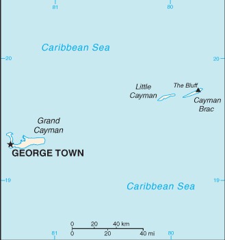
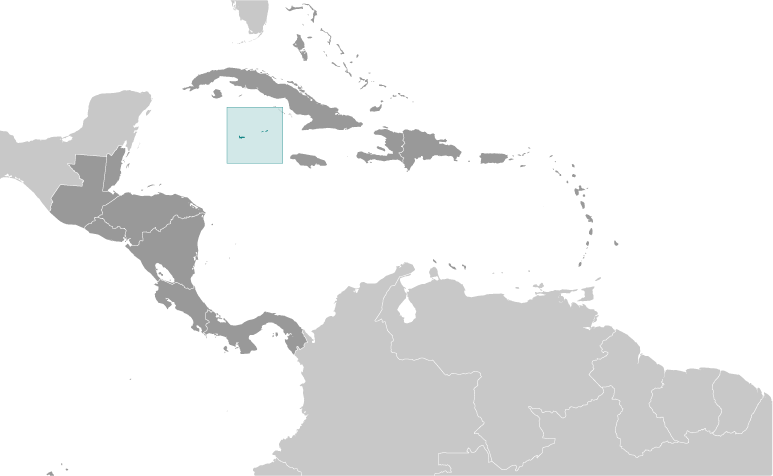
Cayman Islands [ United Kingdom ] (Overseas Territory):

Advertisement


GPS points near Governors Creek

square West Bay (1 km)

square Jacksons Pond (1 km)


square Welch Point (2 km)


square Dolphin Point (2 km)

square Long Point (2 km)

square Timms Point (2 km)

square Botabano (3 km)


square Coral Gables (3 km)


square Vicksville (3 km)

square West Bay (3 km)


square West End (3 km)

square Barkers (4 km)


GPS points from Cayman Islands [ United Kingdom ] (Overseas Territory)

square Long Point Cayman Islands (general)

square Blossom Village Cayman Islands (general)

square Clarinda Beach Cayman Islands (general)

square Ireland Bluff Cayman Islands (general)

square Crawl Bay Cayman Islands (general)

square Cayman Islands Cayman Islands (general)

square West End Point Cayman Islands (general)

square Sand Cliff Point Cayman Islands (general)


viewweather.com sv.ViewWeather.com
fr.ViewWeather.com
da.ViewWeather.com
de.ViewWeather.com
es.ViewWeather.com
www.carpati.org
www.searchromania.net
Deblocari usi
es.getamap.org
fr.getamap.org
de.getamap.org
nl.getamap.org
da.getamap.org
www.getamap.org
Links
Terms of use
Privacy policy

# 0.0792 sec 

contact AT getamap.net

© 2006 - 2024  https://www.getamap.net/